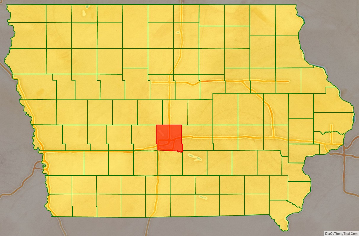
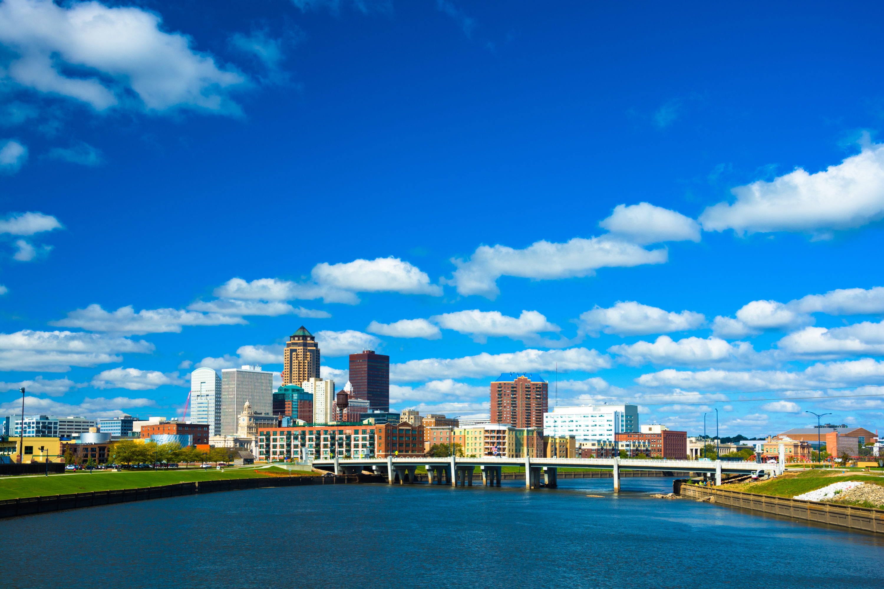
Polk County is located in the U.S. state of Iowa. As of the 2020 census, the population was 492,401. making it the most populous county in Iowa, and was estimated to be 505,255 in 2023. It is home to over 15% of the state's residents. The county seat is Des Moines, which is also the capital city of Iowa. Polk County is included in the Des Moines–West Des Moines, IA Metropolitan Statistical Area.
History
On January 13, 1846, the legislative body of the Iowa Territory authorized the creation of twelve counties in the Territory, with general descriptions of their boundaries. On January 17 they further enacted a resolution setting the effective date of the county government for Jasper and Polk Counties as March 1, 1846. Polk County's name referred to United States President James K. Polk, who served from 1845 to 1849.
The first courthouse, a two-story structure, was built in Des Moines in 1846. Rapid settlement and commercial growth in the county soon rendered this building insufficient, so construction of a larger building was initiated in 1858. Due to construction delays and the onset of the Civil War, the structure was not completed until 1866. The present courthouse was erected in 1906, and in 1962 it was extensively renovated and enlarged.
Geography
According to the United States Census Bureau, the county has a total area of 591.888 square miles (1,532.98 km2), of which 572.720 square miles (1,483.34 km2) is land and 19.168 square miles (49.64 km2) (3.0%) is water. The county is bisected by the Des Moines River.
Major highways
- Interstate 35
- Interstate 80
- Interstate 235
- U.S. Highway 6
- U.S. Highway 65
- U.S Route 69
- Iowa Highway 5
- Iowa Highway 17
- Iowa Highway 28
- Iowa Highway 141
- Iowa Highway 160
- Iowa Highway 163
- Iowa Highway 415
- Iowa Highway 210
Transit
- Des Moines Area Regional Transit
- Burlington Trailways
- Jefferson Lines
- Des Moines Bus Station
Demographics
As of the third quarter of 2024, the median home value in Polk County was $285,410.
As of the 2023 American Community Survey, there are 202,404 estimated households in Polk County with an average of 2.41 persons per household. The county has a median household income of $81,621. Approximately 11.5% of the county's population lives at or below the poverty line. Polk County has an estimated 71.0% employment rate, with 39.5% of the population holding a bachelor's degree or higher and 83.7% holding a high school diploma.
The top five reported ancestries (people were allowed to report up to two ancestries, thus the figures will generally add to more than 100%) were English (85.2%), Spanish (7.8%), Indo-European (1.5%), Asian and Pacific Islander (3.2%), and Other (2.2%).
The median age in the county was 36.8 years.
Polk County, Iowa – racial and ethnic composition
Note: the US Census treats Hispanic/Latino as an ethnic category. This table excludes Latinos from the racial categories and assigns them to a separate category. Hispanics/Latinos may be of any race.
2020 census
As of the 2020 census, there were 492,401 people, 196,891 households, and 121,993 families residing in the county. The population density was 860.5 inhabitants per square mile (332.2/km2). There were 210,184 housing units at an average density of 367.3 per square mile (141.8/km2). The racial makeup of the county was 75.93% White, 7.23% African American, 0.46% Native American, 4.98% Asian, 0.06% Pacific Islander, 3.88% from some other races and 7.45% from two or more races. Hispanic or Latino people of any race were 9.76% of the population.
2010 census
As of the 2010 census, there were 430,640 people, 170,197 households, and _ families residing in the county. The population density was 750.5 inhabitants per square mile (289.8/km2). There were 182,262 housing units at an average density of 317.6 per square mile (122.6/km2). The racial makeup of the county was 84.73% White, 6.00% African American, 0.32% Native American, 3.53% Asian, 0.06% Pacific Islander, 2.93% from some other races and 2.42% from two or more races. Hispanic or Latino people of any race were 7.58% of the population.
2000 census
As of the 2000 census, there were 374,601 people, 149,112 households, and 96,624 families residing in the county. The population density was 658.3 inhabitants per square mile (254.2/km2). There were 156,447 housing units at an average density of 275.0 per square mile (106.2/km2). The racial makeup of the county was 88.34% White, 4.84% African American, 0.27% Native American, 2.63% Asian, 0.06% Pacific Islander, 2.22% from some other races and 1.66% from two or more races. Hispanic or Latino people of any race were 4.40% of the population. 25.9% were of German, 10.6% Irish, 9.0% English and 8.4% American ancestry.
Of the 149,112 households 32.20% had children under the age of 18 living with them, 51.00% were married couples living together, 10.30% had a female householder with no husband present, and 35.20% were non-families. 28.10% of households were one person and 8.60% were one person aged 65 or older. The average household size was 2.45 and the average family size was 3.04.
Age spread: 25.70% under the age of 18, 9.40% from 18 to 24, 32.20% from 25 to 44, 21.50% from 45 to 64, and 11.10% 65 or older. The median age was 34 years. For every 100 females, there were 94.20 males. For every 100 females age 18 and over, there were 90.70 males.
The median household income was $46,116 and the median family income was $56,560. Males had a median income of $37,182 versus $28,000 for females. The per capita income for the county was $23,654. About 5.30% of families and 7.90% of the population were below the poverty line, including 9.70% of those under age 18 and 6.40% of those age 65 or over.
Government and infrastructure
The Iowa Department of Corrections Iowa Correctional Institution for Women is in Mitchellville and in Polk County.
Population ranking
The population ranking of the following table is based on the 2020 census of Polk County.
† county seat
Education
School districts include:
- Ankeny Community School District
- Ballard Community School District
- Bondurant-Farrar Community School District
- Carlisle Community School District
- Collins-Maxwell Community School District
- Dallas Center-Grimes Community School District
- Des Moines Independent Community School District
- Johnston Community School District
- Madrid Community School District
- North Polk Community School District
- PCM Community School District
- Saydel Community School District
- Southeast Polk Community School District
- Urbandale Community School District
- West Des Moines Community School District
- Woodward-Granger Community School District
Attractions
- Adventureland Resort
- Blank Park Zoo
- Iowa State Capitol
- Iowa State Fair
- Living History Farms
- Science Center of Iowa
- Valley Junction
- Wells Fargo Arena
Communities
Cities
Census-designated place
- Saylorville
Unincorporated communities
Townships
See also
- Polk County Courthouse
- Iowa State Capitol
- Terrace Hill also known as Hubbell Mansion, Benjamin F. Allen House, or the Iowa Governor's Mansion
- National Register of Historic Places listings in Polk County, Iowa
References
External links
- Polk County – official website